After devastating natural disasters, we see a lot of images of the destruction from the ground. NASA images provide an opportunity to look at these tragic events from above and gain new perspective. We look at some images NASA gathered over the past year of natural disasters like Hurricane Marie, the California wildfires and more.
Cyclone Marcus
Cyclone Marcus was the first category 5 cyclone of 2018 and the strongest to hit Darwin, Australia, since 1974. (NASA)Cyclone Marcus hit Australia from March 14, 2018, to March 27, 2018. It was the first category 5 cyclone of 2018 and the strongest to hit Darwin, Australia since 1974.
Snowstorm batters the East Coast
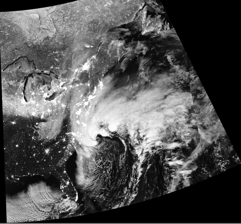
During the first week of 2018, millions of people along the East Coast got battered with snow and ice, gusty winds, and had to deal with power outages, travel delays, school closings, and flooding.
Fires in California
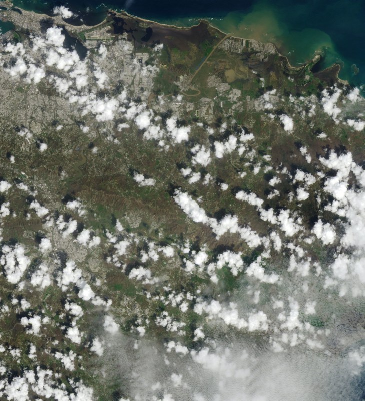
NASA picture shows the effect of the Thomas Fire in December, 2017. (NASA)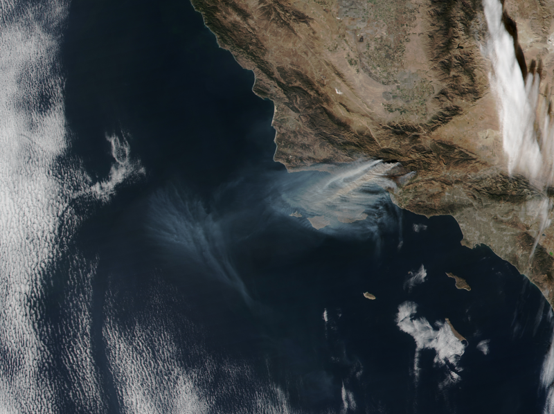
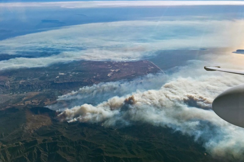
The Thomas fire, in 2017, shattered the record for fires in December. It was the second largest fire on record in California. When it was only 60 percent contained, it had already scorched 272,000 acres.
Flash Floods in Greece
On November 14, 2017, a slow-moving weather system in the Mediterranean cause torrential rain and flash floods in Greece. (NASA)On November 14, 2017, a slow-moving weather system in the Mediterranean cause torrential rain and flash floods in Greece. In Mandra, a town west of Athens, hundreds of people were left homeless and the flood claimed several lives.
Three Hurricanes in the Atlantic
Three hurricanes gather in the Atlantic in Sept. 2017.On September 6, hurricanes Katia, Irma, and Jose lined up across the basin. You can see all three in this image, captured that day by the Visible Infrared Imaging Radiometer Suite (VIIRS) on the Suomi NPP satellite.
Hurricane Maria Hits Puerto Rico
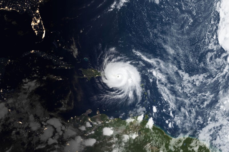
Hurricane Maria devastated Puerto Rico in September 2017. Electricity was out throughout the entire island. Powerful winds ripped apart houses and tore power lines. Cell phone service was offline in many areas and flooding happened in most coastal cities. Flash floods and landslides occurred because of extreme rainfall rates.
Flooding in Peru
In April 2017, several weeks of intense rain caused severe floods and mudslides in Peru. (NASA)In April 2017, several weeks of intense rain caused severe floods and mudslides in Peru. In this picture, captured by the Operational Land Imager (OLI) on Landsat 8, you can see flood waters near the town of Parachique. More than 180,000 houses throughout the country were flooded, according to Lutheran World Relief.
Russian Volcano Rumbles
A long-dormant volcano on Russia’s Kamchatka Peninsula erupted in March 2017. NASA reports that several satellites caught images of a thick, ash-laden plume trailing from Kambalny. (NASA)In March 2017, a long-dormant volcano on Russia’s Kamchatka Peninsula erupted. NASA reports that several satellites caught images of a thick, ash-laden plume trailing from Kambalny. By 1:34 p.m. local time the day it erupted, the plume stretched about 100 kilometers (60 miles) to the southwest. By March 26, ash falls covered the ground on both sides of the volcano.
Sediment Flows into Monterey Bay
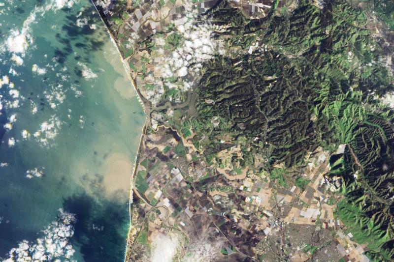
On Feb. 27, 2017, the Salinas and Pajaro rivers dumped sediment into Monterey Bay. The Advanced Land Imager (ALI) aboard NASA’s Earth Observing-1 (EO-1) satellite captured this natural-color image. NASA says that high water levels in several rivers in Monterey County forced evacuations in late Feb., and high winds left thousands of people without electricity.
Underwater Eruption Near Tongatapu
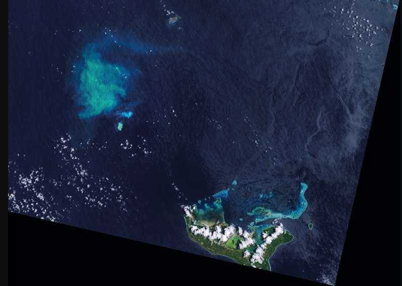
An underwater release of gases, rocks and volcanic fluids caused a plume to come from a seamount located about 20 miles from Tonga’s main island of Tongatapu. The eruption might also have disturbed sediment on the seamount. Underwater eruptions are common in this area and like how ash from volcanic eruptions is a well-known threat to airplanes, underwater eruptions are a hazard for boats. According to NASA, some underwater eruptions produce rafts of light, porous rock called pumice that float on the sea surface and can clog ship engines.
Meet your guide

More Like This


This article appeared in an InsideHook newsletter. Sign up for free to get more on travel, wellness, style, drinking, and culture..