With unique geological formations and great natural wonders that span granite monoliths to ancient groves of giant sequoia trees, it’s easy to see the appeal of California’s diverse landscapes. According to National Park Service numbers, two of the country’s 15 most-visited parks last year were here in the Golden State: Yosemite racked up 3.6 million visitors, while Joshua Tree counted 3 million. But have you ever dreamed of visiting all the national parks across the Great State of California in one epic, almost month-long adventure that only requires around 30 hours of total drive time while camping or glamping along the way?
If the answer is yes, then our trip begins among the coastal redwoods of Humboldt County and meanders its way south, hitting all the Sierra parks and Pinnacles before dropping into the Sonoran and Mojave Deserts and culminating in the Channel Islands. Also included: iconic sights, the best hiking trails and campsites to pop up the tent — or for those who prefer more comforts, cottages, cabins and retro Airstreams to rent. Plus, there are mini detours to see attractions or make overnight stops between parks. To make this budget-friendly, we suggest purchasing an America the Beautiful National Park Pass ($80) before setting out. To crunch and compare numbers, you’ll pay $30 for Joshua Tree and $35 for Yosemite entrance fees alone, plus it’s valid for 12 months and gets you into all 400-plus national park sites across America. Happy trails!
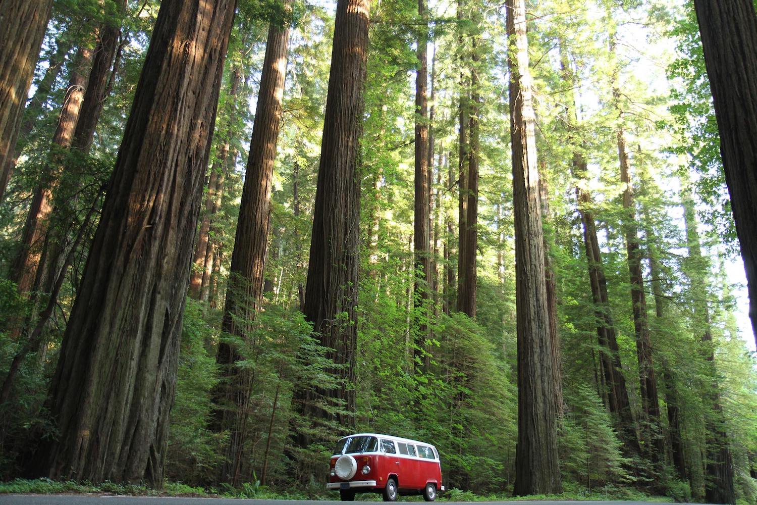
Redwood National and State Parks
Iconic sight: Majestic coastal redwood trees — which can live for over 2,000 years and grow more than 300 feet tall — are the star attraction at this World Heritage Site with the Lady Bird Johnson Grove one of the most spectacular groves of ancient, old-growth redwoods in the world.
Best trail: The easy 3-mile Big Tree Loop (via Karl Knapp and Cathedral Trees) takes in some of the park’s most scenic groves with a variety of upland and lowland redwoods. For something longer, consider the 10.4-mile out-and-back James Irvine Trail to the beach at Fern Canyon.
Best campsite/lodging: Camp underneath the shade of ancient trees at Jedediah Smith Redwoods State Park Campground (the only campground within the park) or get cozy with a fully equipped coastal cottage at Trinidad Bluffs, which are just minutes from the park.
Directions: It’s a 233-mile drive from Redwood to Lassen with great stops along the way including Redding and Eureka with the Klamath River and Trees of Mystery top places to visit.
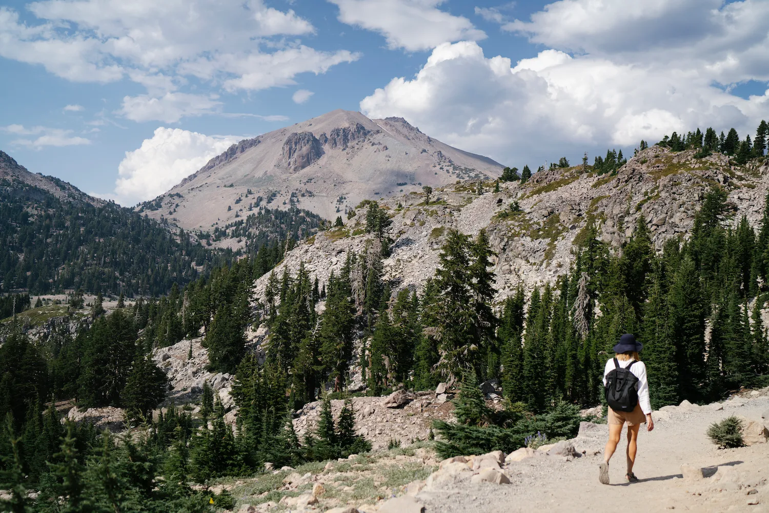
Lassen Volcanic National Park
Iconic sight: One of this under-the-radar park’s most famous geothermal areas is Bumpass Hell, where a boardwalk takes you up close to boiling springs, fumaroles and mud pots. The Fantastic Lava Beds are another premier destination, best viewed from the top of Cinder Cone.
Best trail: Go straight to the top for money-shot views and photo-ops with the challenging 4.9-mile out-and-back Lassen Peak trail or chill on the 1.9-mile Manzanita Lake loop.
Best campsite/lodging: Country-chic bed and breakfast St. Bernard Lodge makes a pleasant home base and is one of the closest hotels to the park entrance. Located one mile south, Manzanita Lake Camping Cabins are more rustic, and you’ll need to bring your own bedding.
Directions: From Lassen, it’s only a five-hour drive to Yosemite’s main entrance, so why not add a detour and overnight in Tahoe and raft the Truckee River or swing through gold-mining boom town Nevada City and stay in a historic and allegedly haunted hotel, The National Exchange.
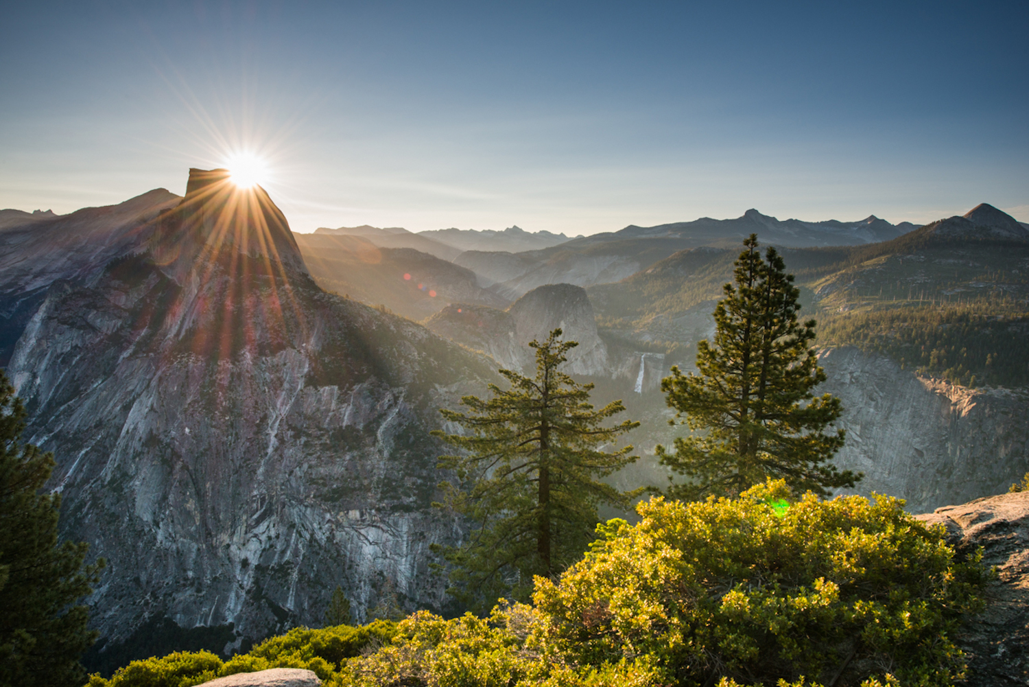
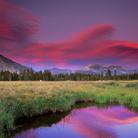
Yosemite National Park
Iconic sight: Considered one of the country’s premier national parks, UNESCO World Heritage Site Yosemite is famous for its natural wonders: towering granite monoliths (see Half Dome) and waterfalls (see the Horsetail Firefall in February), deep valleys (see Glacier Point lookout and Tunnel View) and giant sequoias (see the Mariposa Grove).
Best trail: The steep 7.2-mile Yosemite Falls Trail rewards with close-up views of the tallest falls in North America. However, there are stellar views of Yosemite Valley, Half Dome and Sentinel Rock should you choose to make the one-mile, 1,000-foot climb to Columbia Rock instead.
Best campsite/lodging: Centrally located near the Merced River, Lower Pines campground is a great spot inside the park. Near the west entrance, Rush Creek Lodge has a very nice spa and pool deck, while Tenaya Lodge is a solid choice in Fish Camp just outside the east entrance.
Directions: From Yosemite, it’s a three-hour and 22-minute drive to Pinnacles, with Gilroy, aka “The Garlic Capital of the World,” a three-mile detour en route. Its downtown is filled with shops and points of interest dedicated to the city’s love affair with this bulbous flowering plant.
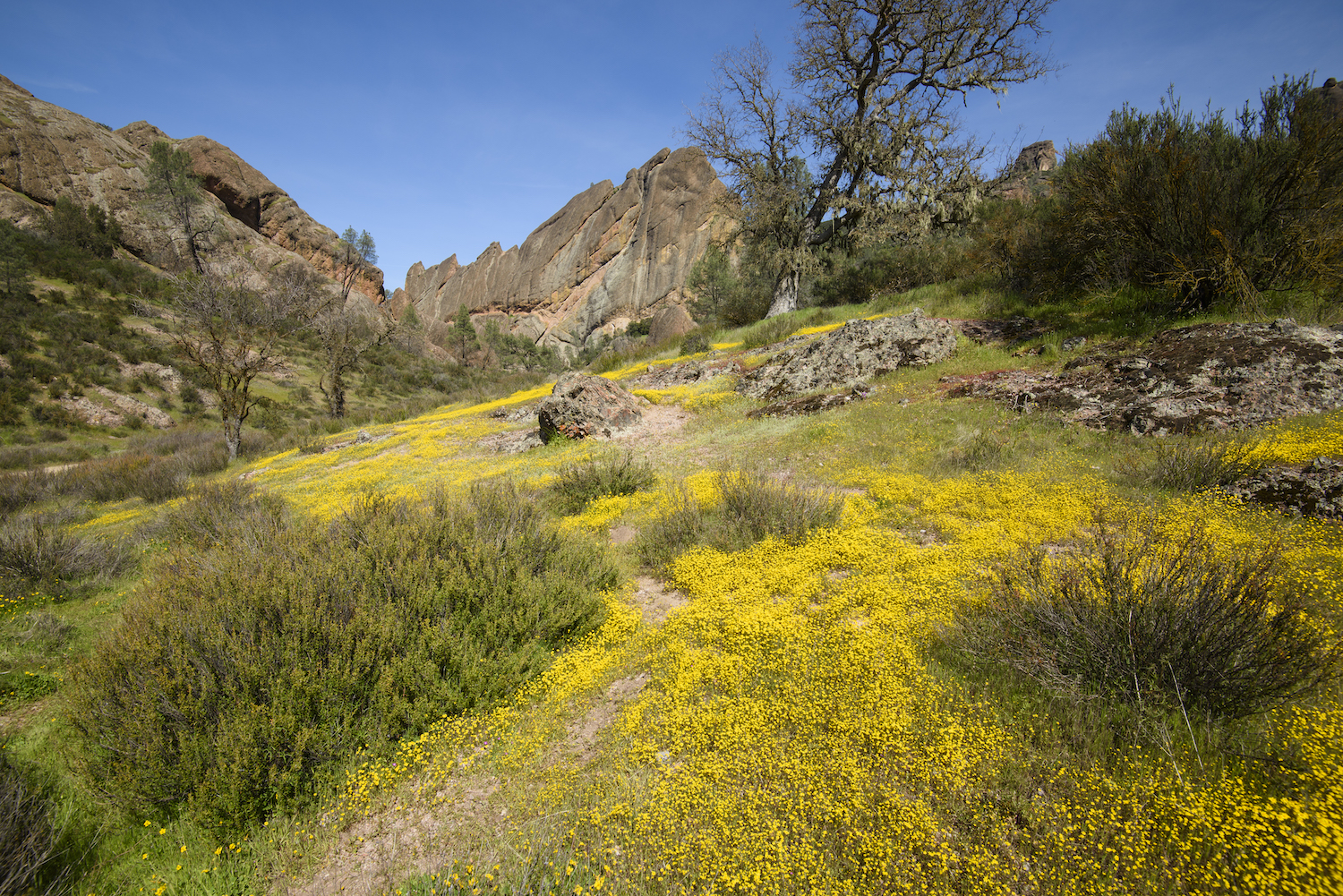
Pinnacles National Park
Iconic sight: Encompassing 26,000 acres of spectacular rock formations and remnants of an extinct, 23-million-year-old volcano, Pinnacles is a popular destination for climbers and hikers. It’s also a release site for captive-bred California condors — look for the majestic birds soaring overhead at the scenic Condor Gulch Overlook, reached by hiking the Condor Gulch Trail.
Best trail: The 8.4-mile High Peaks and Balconies Cave Loop Trail is challenging, but if you start counterclockwise, you’ll scramble up steep carved steps near the peak first before being rewarded with cooler temperatures inside the talus caves (bring a flashlight) towards the end.
Best campsite/lodging: Located on the park’s east side, Pinnacles Campground has 134 sites, a handful of cabins (with and without electric hookups), and lots of nice extras, including hot showers, a swimming pool, a general store and wifi. Pets are allowed on a leash.
Directions: It’s a straight three-hour shot along State Route 198 from Pinnacles National Park to the Sierra Drive exit for Sequoia & Kings Canyon National Parks — but stretching the legs in downtown Hanford with an ice cream from Superior Dairy is a nice way to break up the drive.
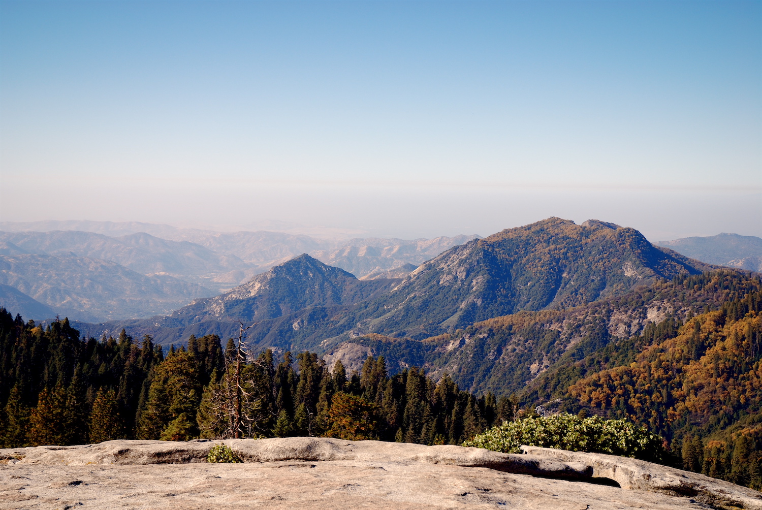
Sequoia & Kings Canyon National Parks
Iconic sight: Established in 1890, Sequoia was the country’s second national park and first in California. Home to majestic giant sequoias, there are several groves to see these awe-inspiring trees up close here, but its most famous, General Sherman, is the largest by volume in the world.
Best trail: Pack a picnic for the moderate 5.7-mile Ella Falls Loop trail near Cedar Grove in Kings Canyon, which is best started clockwise (so you get the hard sections out of the way first) and offers views of Ella Falls, Sequoia Lake and The General Grant Tree.

A Viking-Inspired Lodge on Big Bear Lake Gets a Chic Update
Get cozy beside the fireplace in lakefront rooms — or standalone cabins — at Marina RivieraBest campsite/lodging: There are 214 campsites scattered across Lodgepole Campground, which is located on the Kaweah River and within easy walking distance of Lodgepole Village, where you’ll find a visitor center, market, shower and laundry facilities. For a cozy cabin with a full kitchen, check out the Silver City Mountain Resort.
Directions: It’s 275 miles from Sequoia to the east Death Valley entrance, which should take just under five hours. If a steak dinner and country music show appeals, stop by Buck Owens Crystal Palace in Bakersfield and crash at the Holiday Inn Express down the road.
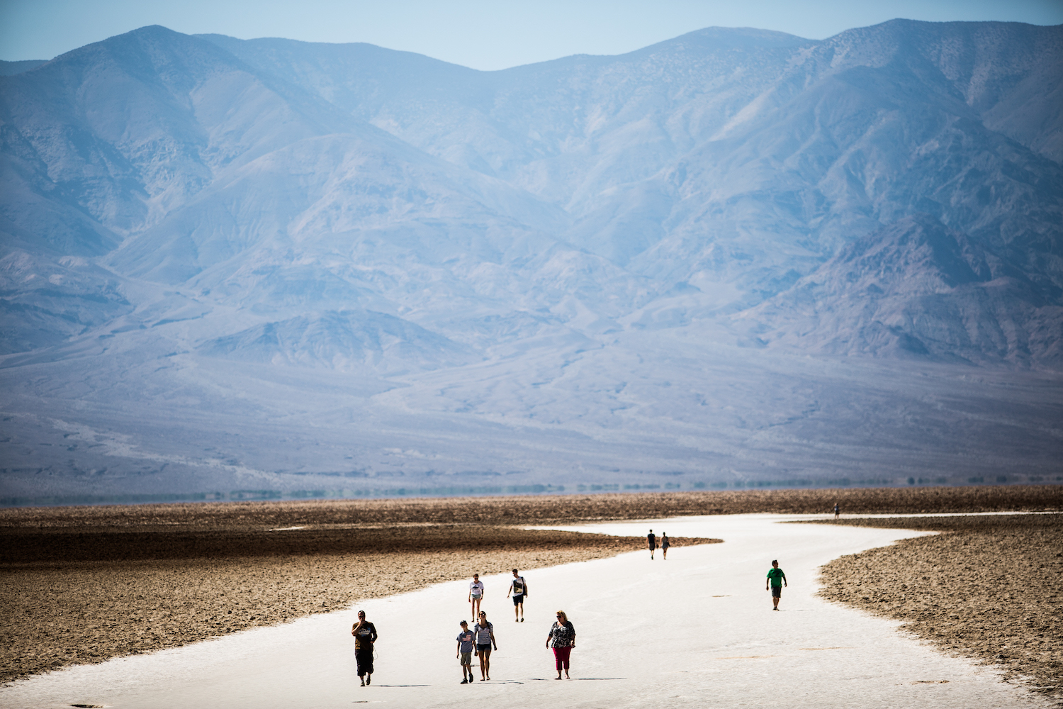
Death Valley National Park
Iconic sight: With its colorful badlands, vast salt flats and sand dunes, Death Valley is a place of striking extremes, where the highest temperature ever was recorded (134 degrees in July 1936). Hikers come for spring wildflower blooms, but Badwater Basin — the lowest point in North America — is a year-round landmark.
Best trail: The 6.4-mile Golden Canyon and Gower Gulch Loop via Zabriskie Point is a solid choice for top-notch scenic views. Set out early in a counterclockwise direction from Zabriskie Point, but pack plenty of water, and bring a hat — it will get hot and there is very little shade.
Best campsite/lodging: For palm trees and a spring-fed swimming pool, you’ll want the historic Inn at Death Valley, although the newer casitas and cottages at The Oasis at Death Valley are a bit more budget-friendly. Only a few campsites are open here during summer, but Fiddler’s and Wildrose are noteworthy options.
Directions: The fastest route between Death Valley’s western entrance and Joshua Tree should take about four hours traveling along CA-127 before cutting through the east side of the Mojave National Preserve. Definitely stop for a soda at Roy’s gas station on Route 66 in Amboy.
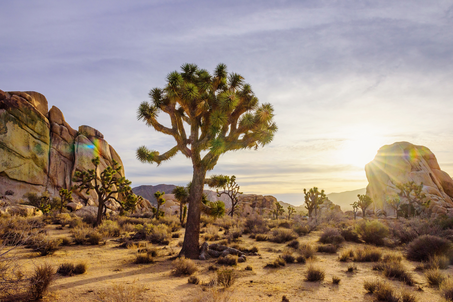
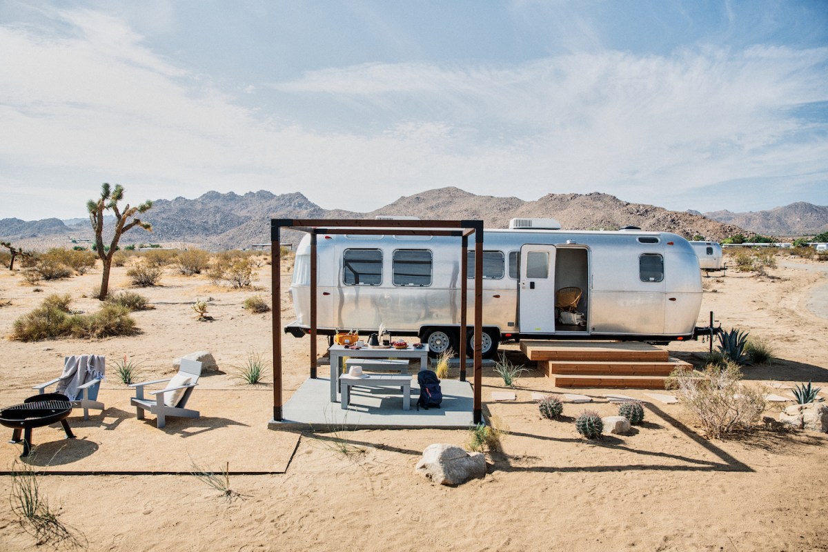
Joshua Tree National Park
Iconic sight: Joshua Tree’s namesake yucca plants, with their spiky outstretched branches notwithstanding. Stargazing opportunities to see countless stars and celestial wonders (JT became a designated International Dark Sky Park in 2017). The otherworldly Cholla Cactus Garden, especially when viewed during sunrise or sunset. All are major draws here.
Best trail: The 6.6-mile Panorama Loop from Black Rock Canyon (also home to a dense grove of Joshua trees) follows a sandy wash to a strenuous uphill climb with little shade (best to set out early and bring plenty of water) but provides killer views of the surrounding mountains.
Best campsite/lodging: Modern Airstream oasis AutoCamp Joshua Tree is located less than 10 minutes from the park entrance and features a clubhouse with cocktail bar and restaurant, plunge pool and fire pits. For traditional tent camping, climbers love Hidden Valley, while Jumbo Rocks is located a short distance from Skull Rock.
Directions: From Joshua Tree, it’s 212 miles or just under a four-hour drive to Ventura. Stop for a soak in Desert Hot Springs or quick bite at the Red Dog Saloon in Pioneertown. Once in Ventura, book a boat ride with Channel Islands National Park concessionaire, Island Packers Cruises.
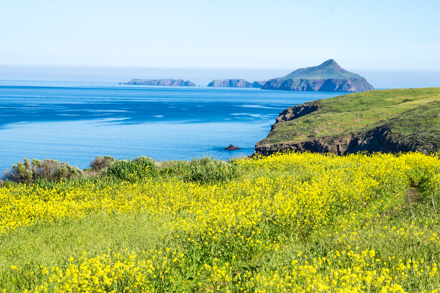
Channel Island National Park
Iconic sight: Being a marine sanctuary means snorkeling and kayaking is excellent here with the sea caves at Scorpion Cove on Santa Cruz Island a highlight. The hiking trails have stunning coastal views too, and afford a chance to see some of the endearing island foxes.
Best trail: The 5.2-mile out-and-back Potato Harbor Trail follows the bluffs to an overlook, which takes in magnificent views to the west and rest of Santa Cruz Island — but another good one is the 4.3-mile Pelican Bay Trail, which leads to one of the most scenic anchorages on the island.
Best campsite/lodging: Camping is available year-round on all five islands, and the largest on Santa Cruz Island (31 total sites) is at Scorpion Canyon. Conditions are primitive — there’s potable water, picnic tables and food storage boxes — but with no on-island transportation, you’ll carry all your gear on and off the boat.
Meet your guide

More Like This
This article was featured in the InsideHook SF newsletter. Sign up now for more from the Bay Area.