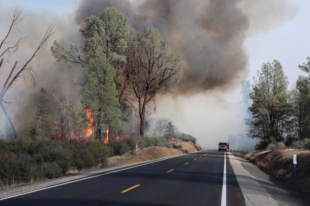
After a historically wet winter, California’s fire season had a slower-than-usual start. But with above-normal temperatures forecast to affect parts of the state through September — plus fire tornadoes now burning Joshua tree forests in the Mojave Desert — the reality for those living and vacationing in California is two-fold: wildfires can start at any time and have been burning more often and with higher intensity. Last year, the Mosquito Fire burned 76,788 acres in Placer and El Dorado counties, but this is considered small when compared to California’s first-ever “gigafire” in the summer of 2020, when a combined total of 8,648 fires burned a mind-boggling 4.3 million acres, resulting in 33 deaths and more than 11,000 structures destroyed. So we decided to ask an expert about what travelers should know before visiting the Sierras during wildfire season.
“With a changing climate, warmer, drier and windier conditions, and less resilient landscapes that haven’t been managed as they should, we’ve seen a significant shift in the way wildfires burn through the landscape in the last 20 years, ” former Cal Fire Chief Deputy Director Christopher Anthony tells InsideHook. “They’re also much harder to contain under certain conditions. It was unthinkable when I started my career 30 years ago [that] we would have a single-ignition fire that would burn nearly a million acres.”
A South Tahoe local, Anthony has been responsible for the implementation of strategic initiatives and policies critical to ensuring wildfire resiliency, community preparedness, technological advancements and operational readiness for more than two decades with the California Department of Forestry and Fire Protection. “Back in 2017, we had another wet winter with a lot of snow in the Sierras, but it really just pushed things later,” Anthony says. “The Thomas Fire burned 281,000 acres in Ventura and Santa Barbara counties and was the largest in the state’s history, but now it’s our eighth-largest fire. I did not think then that we would see another fire larger than 280,000 acres during my career with Cal Fire, but here we are.”
Basically, the wet winter in the Sierras isn’t a hedge against a rough fire season. Whether you live near a Fire Hazard Severity Zone (FHSZ) or plan to visit the Sierra Nevada Mountains to hike, camp or rent an Airbnb, here’s what he says you need to know.
I’m Planning to Camp for a Few Days. What Should I Think About Before I Go?
Keep tabs on heat indexes, wind and red flag warnings. You should know current conditions and forecasted weather because if the National Weather Service predicts red flag conditions, this can impact escape routes. Familiarize yourself with the campground [and] where residential structures and critical infrastructures are located. What are the best routes of travel in and out of that area? A coordinated evacuation happens rapidly, and you should always be prepared.
What About Having a Campfire?
Every national forest has slightly different rules. For instance, campfires are not allowed outside of improved campgrounds in the Lake Tahoe Basin, so find out regulations where you’re staying. You can apply for a California Campfire Permit online, but people need to ask themselves whether it’s the right thing to do, even if allowed. Is it worth an ember coming out and potentially starting the next big fire? Portable propane fire pits are a great alternative to burning wood.
What Should I Look for When Renting an Airbnb?
Is it located in a well-built subdivision with good roads and fire hydrants, or a more remote area at the end of a long, dead-end road or single-lane driveway? That road network will be critical to your ability to evacuate quickly and not get cut off in the event of a fire. Is it surrounded by a lot of vegetation and is the area considered high-risk? Some owners provide community evacuation plans for guests to familiarize themselves with, but it’s not mandated, so do your homework.

An Honest Conversation About California, Wildfires and the Future of Paradise
Artist Eve Werner has no interest in sugarcoating the fire and brimstone yet to comeI’m on a Trip and a Fire Starts in the Area. What Should My First Steps Be?
Pre-familiarize yourself with the major transportation routes in and out of where you’re vacationing or traveling through, especially if it’s a high-risk area. Don’t wait until someone knocks on your door if there’s a fire burning nearby and it seems unsafe to stay. Generally, when these fires start, evacuation zones are put into place, and reverse 911 systems are deployed to notify people via cell phones or landlines. Even if you don’t get that call, the best thing you can do is get ready to evacuate and keep monitoring conditions.
What About Evacuations?
Do your due diligence before traveling. Being evacuated in an unfamiliar environment is disorienting when you have to leave quickly, quite possibly in the middle of the night. It can be a very stressful event, and if you’re unfamiliar with the area, it will be much more difficult.
Is There an Emergency Alert System I Can Tap Into?
Several technologies are available to make notifications, so even if someone was from out of the area, there are ways the wireless emergency alert system can push notifications to people. For example, El Dorado County has a reverse 911 Code RED alert system for homeowners, which I’m enrolled in, so if they put something out, I will get that on my cell phone and landline. We all rely on our cell phones, but a paper map is a great to have in remote areas with spotty service.
Any Other Recommendations?
I always advise people to check the Forest Service fire and aviation alerts and notices page and the Cal Fire Incident Map for current emergency incidents. Also check the status of the park or particular forest you plan to visit before traveling. If you’re seeing reports of prime wildfire conditions and red flag warnings, it’s not the time to go camping, so consider postponing the trip.
Meet your guide

More Like This
This article was featured in the InsideHook SF newsletter. Sign up now for more from the Bay Area.