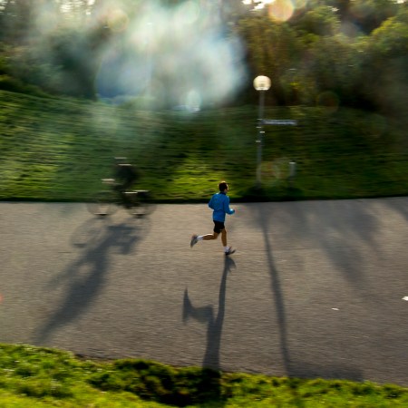
Chicago has a lot of things going for it, but arresting natural landscapes aren’t one of them. Sure, there’s fresh water to spare, but we’ve got no mountains, no cliffs, no otherworldly vistas. Hell, the closest National Parks are sand dunes, a freaking cave and the St. Louis Arch. You’d have to go all the way to the Great Smoky Mountains if you wanted to get an altitude change.
As residents of America’s second flattest state, we bristle a bit when we see posts from our sister cities talking about quick trips into Redwood forests or Joshua Tree. Taking a hike that’s inspiring or challenging is complicated for us — though not impossible.
Since hiking is good for the body, mind and spirit — and our collective mental health can use all the help we can get right now — here’s a roundup of BIG hikes you can take in the region. The goal with this list is long trails you can get to without spending the night away from home, because COVID.
And, yes, we have to worry about the weather here, so you better head out soon or invest in some snowshoes.
Longest: Ice Age Trail
Trail Specs: 1,200 miles
Highlights: Pastoral wilderness
Map: Digital map of entire trail via IceAgeTrail.org
If you’ve done any hiking in Wisconsin, there’s a good chance you’ve crossed this path. The Ice Age Trail is “a thousand-mile footpath” slicing around Wisconsin from north of Minneapolis to east of Eau Claire then plummeting as far south as Janesville before it heads up to Sturgeon Bay. Those who take on the trek walk in the footsteps of the ancient glaciers that carved out the Great Lakes. So you could have your own mini-Wild experience and spend a couple weeks backpacking, or just hop on at the points just north of the Illinois border. The Ice Age Trail website has a ton of great information to help you, including itineraries for dozens of points on the trail and each is customized by ability type.
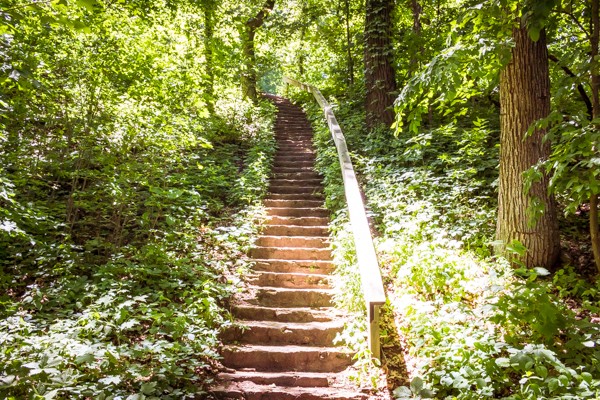
If you don’t want to spend the night, there are two portions of trail that are close enough to do in a day: Devil’s Staircase near Janesville, and a trail in Kettle Moraine’s prairie.
Devil’s Staircase mixes paved sections with technical elements, crescendoing in a single path ascent to a rocky ledge above a river. The most important rule with this one is don’t confuse it with Devil’s Lake — that’s another hour north. Devil’s Lake is one of Wisconsin’s most visited parks — meaning there’s a lot of information about it online — so make sure you aren’t headed there by accident. The trailhead you’re aiming for is in Janesville, almost two hours from Chicago. Park at Riverside Park and follow the trail along the Rock River. You’ll pass a golf course and the Rotary Gardens. Here’s the whole hike mapped out.
Kettle Moraine is a state park known for forests, prairies and kettle lakes. The namesake of the Ice Age trail are the glaciers that passed over the land; during that process, they left behind depressions filled with semi-buried blocks of ice. As the ice melted, they created these kettle lakes. Park at the Ice Age Trail Parking Lot Monches/Merton (Hartland, WI 53029) then head north on the Loew Lake trail or south to the Monaches segment.
Scrappiest: Chicago Outerbelt
Trail Specs: 210 miles
Highlights: Chicago Botanic Gardens, Lincoln Park and Brookfield Zoos, Middelfork Savanna
Map: Via Hiking Project
The Outerbelt is an amalgamation of dozens of hiking paths and natural spaces in the Greater Chicago area. A couple years ago, some hikers realized Chicago parkland and trails actually connect into a giant loop stretching across Cook and Lake counties, and have been trying to get the Outerbelt to find popularity as a thru-hike since. Before the pandemic, REI even offered guided group thru-hikes — i.e., backpacking and camping while completing the entire loop — so keep an eye out when things open up if you’re looking for a go at the whole shebang.
Starting at Buckingham Fountain, hikers can skirt along the Indiana border before following rivers upstream to the north suburbs. It’s like the old song tells us, “the Lakefront Trail’s connected to the Burnham Greenway. The Burnham Greenway’s connected to the Thorn Creek Trail. The Thorn Creek Trail’s connected to the Cal-Sag” … on and on until you swoop over to the North Branch trail and back onto the Lakefront.
Since nothing is too far from reach in any direction, I recommend choosing a path based on scenery. There are urban routes skirting the lake, but also forests, watersheds, meadowlands, secluded campgrounds and even a rare tallgrass savanna. Avid hikers: try a neighborhood or trail you haven’t been to yet. If you’ve seen the Skokie Lagoons, opt for Sag Valley Trails in Palos. If you’ve only ventured on the Des Plaines Trail at Schiller Woods, make your way up to the Van Patten Woods. Same goes for the Lakefront Trail: if you haven’t seen both the north and south sides of this beauty, you’re simply screwing up.
This site breaks down the scrappy Outerbelt into 11 different day hikes of 12-20 miles each. That’s plenty of ground to cover at home before you head out West.
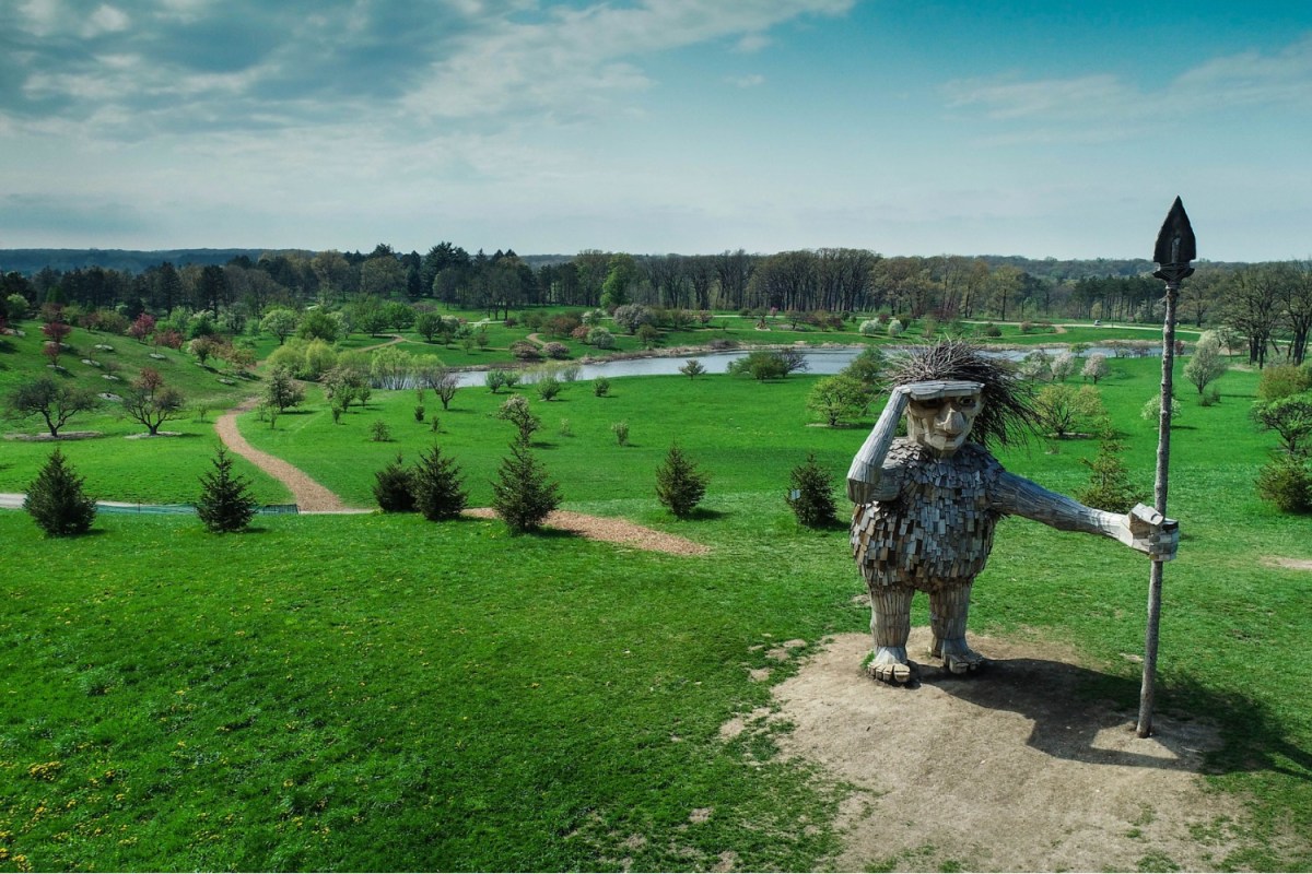
Most Plants: Morton Arboretum
Trail Specs: 16 miles
Highlights: Great fall foliage, massive Danish troll sculptures, easy and beautiful walking paths
Map: Via Morton Arboretum
The Chicago Botanic Garden is encased in the Outerbelt loop, but Morton Arboretum falls outside it. The “Champion of Trees” is absolutely worth its own trip. Professional green thumbs maintain 1,700 acres of deep woods, wetlands and prairies. You never get the feeling that you’re in the middle of nowhere, but city dwellers will feel recharged while surrounded by hundreds of thousands of plants.
Don’t be fooled by the main parking lot. The property is laid out like a national park, where guests can follow one-way roads as they wind through miles of trails, then, when some scenery strikes inspiration, turn off into one of the small parking areas and hit mulch-covered trails. The paths here are easy to access and well-maintained.
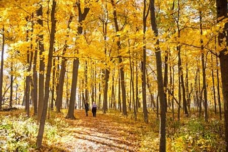
Ambitious hikers could try to tackle the whole place, but there are two distinct sections: the West and East side. The West side has more water, including a path following a flowing river. The East side has the East Woods, which are gorgeously yellow in autumn, and if you visit after the leaves fall, the Heritage Trail which passes the oddly located Big Rock, a 14-ton granite boulder. If hiking with kids — or a sense of whimsy — consult the Arboretum’s Troll Hunt Map to ensure you come across the colossal wooden trolls, one of which is 60 feet long. The Danish art installation is on view through early 2021.
No matter which path you take, tickets are required. The Arboretum is enforcing timed entry to digitally create social distancing via capacity limits, so be sure to book in advance. Their event calendar is still going strong and they’ve adjusted their programming to fit COVID precautions. Non-hikers should consider their drive-through light shows in late November or try their audio tour now.
Best Urban Hike: Jackson Park + Midway Plaisance + Washington Park
Trail Specs: Choose your own adventure means 1-10 miles
Highlights: Fountain of Time, University of Chicago, Statue of The Republic, Lake Michigan
Map: Nothing tricky here, just Google Map it
If you listen to President Trump, you’d think Chicago is a warzone covered in heaps of burning flags, but we know all corners of the city offer beauty and respite, and one such gem is a series of connected parkways on the South Side. The goal of this urban “hike” is to meander through Washington Park, the Midway Plaisance and Jackson Park; bonus points if you head onto the lakefront path from there. For the unfamiliar, these three parks showcase some of the city’s most dazzling green spaces and criss-crossing paths can add up to an out-and-back distance of over seven miles.
You could start from either side, but I recommend parking near the DuSable Museum of African American History, then heading north into Jackson Park before looping back. Or ditch the car altogether and take the Green Line to the Garfield stop.
Washington Park is definitely the sleeper of the three parks. It’s simple, quiet and so old President Ulysses Grant planted a tree in it. This section is about getting the legs warmed up as you walk through native prairie, wetlands and a lagoon. Contemplate the circle of life at the Fountain of Time sculpture.
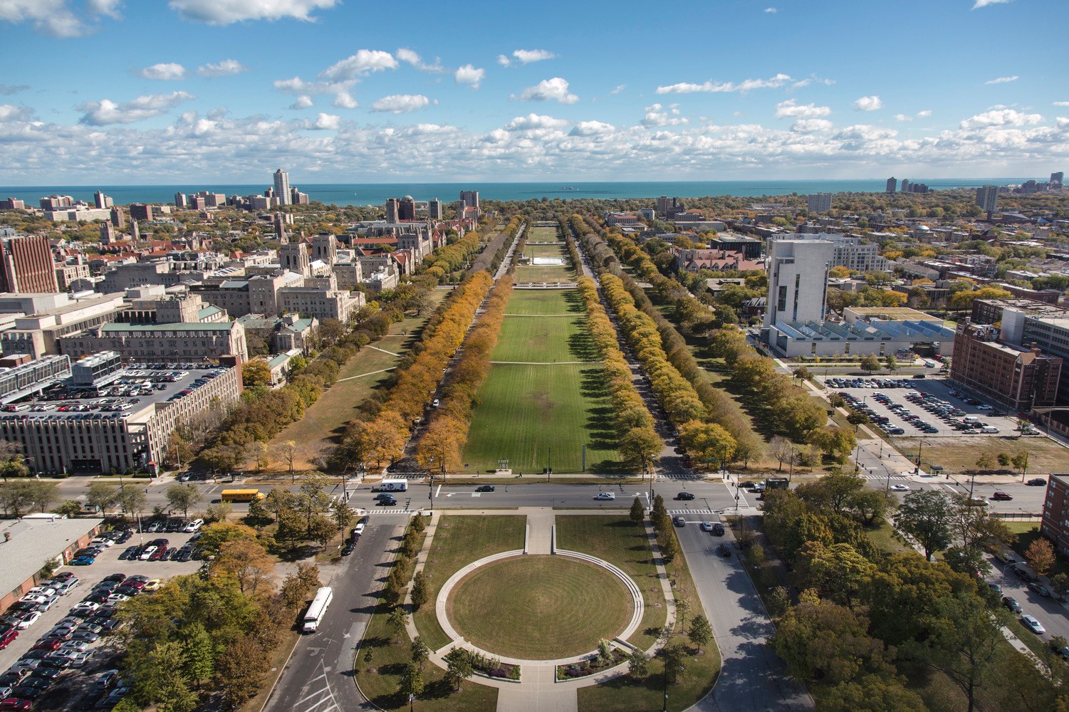
Once you hit the Midway, the scenery opens up and walkers are treated to the gothic architecture of The University of Chicago — gotta love a quad in fall. This stretch is listed on the National Register of Historic Places and some features are Designated Chicago Landmarks. Originally planned as a canal that could ferry residents from the lake into Washington Park, sans water feature it’s still the perfect spot to read a book or toss a ball around, plus there’s a skating rink in cold months.
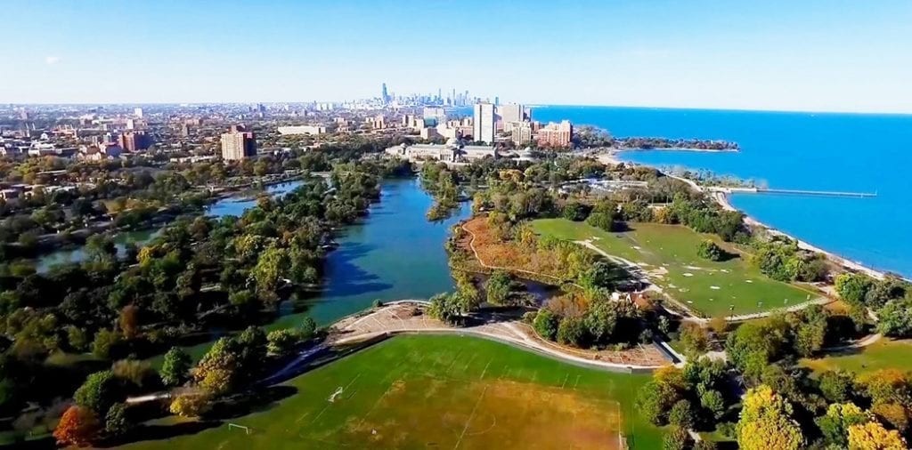
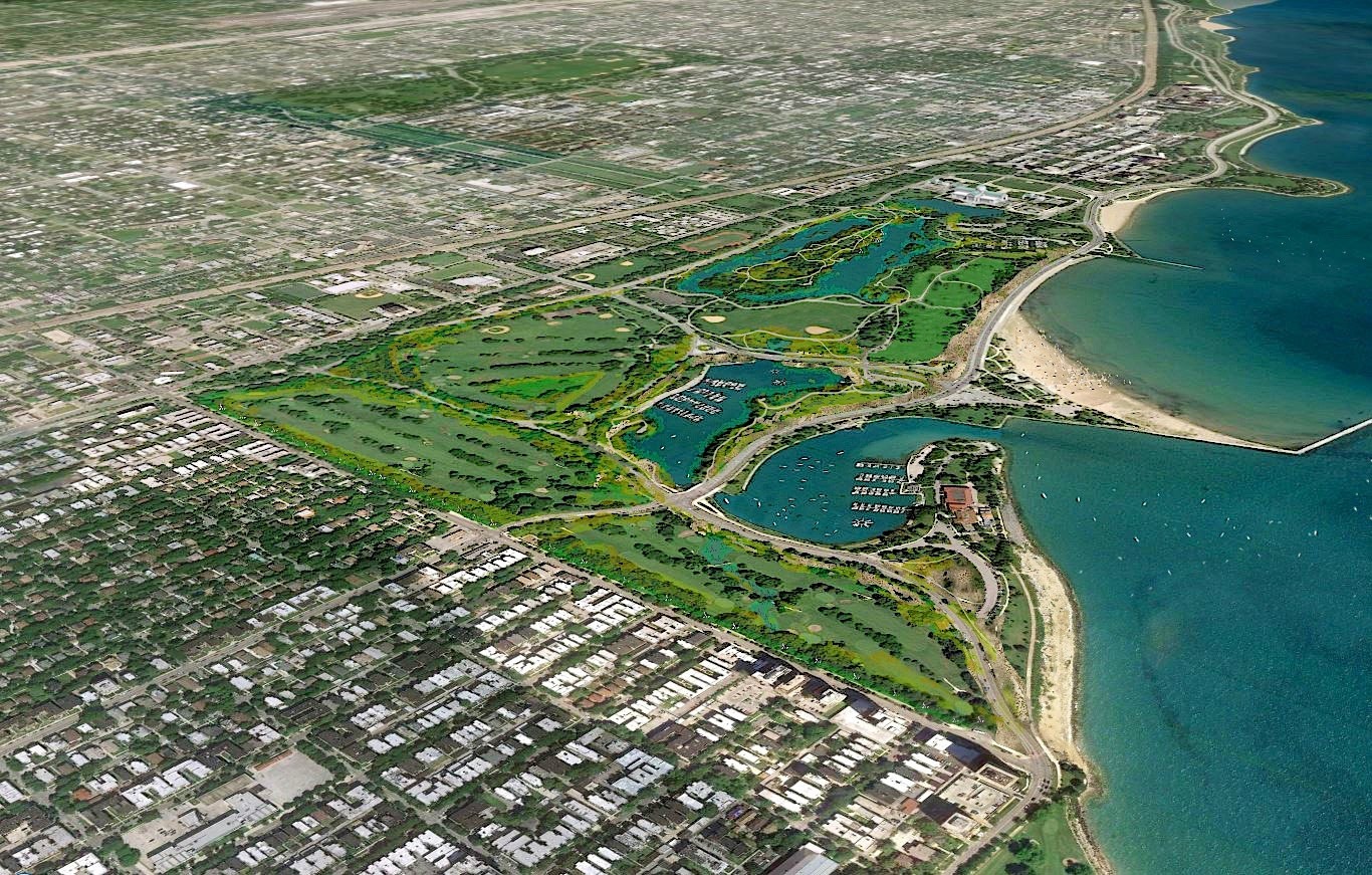
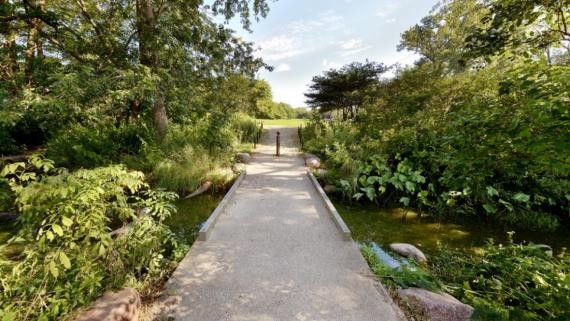
The third (and largest) park, Jackson, houses wooded trails, expansive fields, a Japanese garden and the golden, glistening Statue of The Republic. Built for the World’s Columbian Exposition in 1893, and bound by the lake on the eastern border, Jackson Park spans 500-plus acres and is probably most recognized as the home of the Museum of Science and Industry. Jackson Park is also the expected home of the Barack Obama Presidential Center and Library, so get your serene hike in before it endures a long season of construction.
After you’ve traversed all three parks, grab some food at a nearby restaurant — Hyde Park is overflowing with good options.
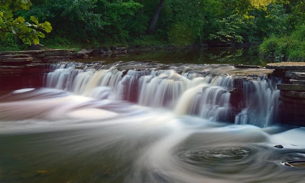
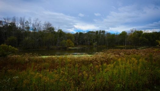
Best Suburban Hike: Waterfall Glen
Trail Specs: 10 miles
Highlights: Small waterfall, native prairie, bluff savanna, wetland potholes
Map: Via DuPage Forest
Located in Darien, Waterfall Glen is a crown jewel in DuPage County’s forest preserve system. This circular trail loops through forests surrounding the Argonne National Laboratory; you’ll stomp crushed limestone paths on its hilly course, winding through diverse ecology that includes prairie, forest and even a savanna. Be warned: hikers, cyclists and horseback riders frequent these trails, so be prepared to share the space. You also have to cross a busy road a few times if you do the entire loop.
Rocky Glen Waterfall and Sawcreek Mill Bluff are the two biggest points of interest, offering an idyllic payoff to committed hikers who plan visits after heavy rains. However, Starved Rock this is not; the water feature here is man-made, built in the 1930s and only a few feet high. Ironically, it’s not even where the park gets its moniker — a former president of the forest preserve board of commissioners named Seymour “Bud” Waterfall is the park’s namesake. Either way, a true nine-plus-mile loop is a rare find, and the scenery is rejuvenating. This is a great hike for late fall, and would even be easy to manage with a light snow.
To park closest to the waterfall section of the trail, enter the park on Northgate Road, just off 1-55 (aka Route 66). If that’s packed (since it’s only a half mile to the falls), try the main lot on Cass Avenue. You’re in high ropes country, and adult jungle gym The Forge sits just on the other side of the Des Plaines River.
Meet your guide

More Like This


This article was featured in the InsideHook Chicago newsletter. Sign up now for more from the Windy City.