Want an unfamiliar look at a familiar place? Preferably with very few people around?
You’re in luck. This city and its surrounds were basically built on that ethos.
Today, we look at five spots in Marin — summits, waterfalls, lakes — that promise killer vistas away from the crowds.
And times being what they are, they’re all safely located on state and municipal land. (Honestly, it killed us not to include the Dipsea, but you’ve already been there, and the Muir Woods National Monument facilities and parking closure, which began on Monday, was too much. Man, we hope that’s all back up soon.)
Here’s to a year of new perspectives — beginning with these.
Image from Marin County Parks
Spot: Mount Burdell
View: Mount Saint Helena, Mount Tam, and S.F.
In brief: Mount Burdell, at 1558 feet, offers a meaty but not-too-taxing peak climb with killer views from the top. Along the way, you might see wildflowers (in late winter and early spring), mountain lions (probably not), and the seasonal Hidden Lake.
Get there: Car is best.
Drinks after: What’s your favorite bar in Novato? Ours is the low-key Brown’s Binyerd.
Image from Roger Hsu/Flickr
Spot: The water’s edge at China Camp State Park
View: The entirety of San Pablo Bay, right across to Vallejo
In brief: As the name suggests, this state park has a fascinating history — it was a shrimp fishing village home to Chinese immigrants in the 1800s. If you’re just here for the views, you can park at Bullhead Flat and walk to Buckeye Point along the Shoreline Trail — or wander up the Bay View Trail for more altitude and a wider panorama.
Get there: Car, again.
Drinks after: Just south in San Rafael — the Mayflower Pub, reportedly the first “British/Irish” pub in the Bay.
Image from David Baron/Flickr
Spot: Bon Tempe Lake
View: It is an extremely lake — and if you get your vantage right, you’ll also the neighboring peaks, including Mount Tam.
In brief: Everyone comes to Mount Tam for the titular summit — but little do most of them know that within that just nearby are a number of often brilliantly blue lakes within the watershed. This is the most striking of them.
Get there: Car, to the neighboring Lake Lagunitas parking lot (see here for parking pass details)
Drinks after: The Gestalt Haus for myriad kinds of beer and the cheapest good food in the Bay, including the new-to-the-menu sloppy Joe’s — nothing’s over $9
Image from Martina Donkers/Flickr
Spot: Carson Falls
View: Not just a waterfall but a waterfall complex, with four pool-and-drop decks.
In brief: Alamere Lake is tucked away on national parkland — so come to Carson Falls instead, in the Marin Municipal Water District (read: shutdown-proof). It’s most impressive, obviously, after a rainy stretch.
Get there: Car, to the trailhead on the Bolinas-Fairfax Road
Drinks after: The Gestalt Haus would still be the top pick, since you’re around the corner from Bon Tempe. But if you’re looking for something else, try the Iron Springs Pub.
Image from Michael McClatchey/Alltrails
Spot: Barnabe Peak
View: Mount Tam, Kent Lake, Tomales Bay, Black Mountain and Mount Diablo
In brief: It’s six miles up and down this 1446-foot peak in Samuel P. Taylor State Park — the views through forest are fine (fern, etc.) but you’ll hear for the vista from the bald summit at the top.
Get there: Park in the dirt pull-out across the road from Devil’s Gulch Horse Camp
Drinks after: Marin’s favorite dive bar: the Paper Mill Creek Salon
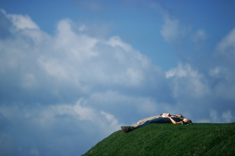
Main image from Liz Watson/Greenbelt Alliance/Flickr
Meet your guide
More Like This


This article was featured in the InsideHook SF newsletter. Sign up now for more from the Bay Area.