Unlike most contested land in the Arab-Israeli conflict, demarcations in the Negev desert are determined by climate change. The literal “lines in the sand” ebb and flow as climatic conditions improve and diminish. For instance, Al-Araqib, a village in the northern part of the desert, is pockmarked with razed buildings, because it’s been rebuilt more than 70 times. Photographer Fazal Sheikh produced this aerial photo essay “Desert Bloom,” as part of a book, The Conflict Shoreline, with Eyal Weizman.
The Al-Turi Cemetery in Al-Araqib, which receives 200 mm rainfall per year, pictured on October 9, 2011. The al-Tūri village in Al-Araqib was first destroyed in July 2010. Those remaining on site moved their homes into the fenced-up area of their ancestral cemetery dating back to 1914. Outside the cemetery fence there are several protest tents, distinct for their blue cloth, marking the area of the destroyed village and the area claimed by the al-Turis. On the left is one of the branches of the Al-Araqib Stream (Naḥal Faḥar in Hebrew). Behind the cemetery is a small tributary dammed by the al-Turis to create a number of small fields, seen here freshly plowed. Like all fields in the Negev they were harvested in September, a few weeks before the photograph was taken. (Fazal Sheikh, Conflict Shoreline, Published by Steidl) The Al-Turi Cemetery in Al-Araqib, which receives 200 mm rainfall per year, pictured on October 9, 2011. The graves at the center of the cemetery are the earliest, dating to before the establishment of the State of Israel and the subsequent displacement of the al-Turis. After the displacement the community still used the cemetery to bury their dead, and started erecting hard grave stones. (Fazal Sheikh, Conflict Shoreline, Published by Steidl) Unrecognized Bedouin settlement of the Abu Asa family , which receives about 100mm of rainfall per year, pictured on October 9, 2011. The darker circular stains indicate the earlier presence of livestock pens (sire). These pens are reconstructed on a yearly basis. Before such pens are reused they are often disinfected by fire, which accounts for an even darker surface. The circular stain at the top of the image, closer to the homes, shows traces of attempts to put out a fire that got out of control. The larger enclosures are for horses or camels. The stains remain in the earth for several years. The gradient of their saturation is an indication of how many rainy seasons have washed away at the stains, indicating age in years. The multiple, but not perfectly overlapping, circles indicate that the place might have been evacuated and reconstructed several times. (Fazal Sheikh, Conflict Shoreline, Published by Steidl) Remnants of Bedouin homesteads in a military live-fire training zone, which receives less than 100mm of rainfall per year, pictured on October 4, 2011. These remains of Bedouin homesteads are located south of Arad, near the unrecognized villages of al-Qurʽan and Qabbuʽa. A current plan to establish a phosphate quarry on the site is facing opposition from both Bedouins in the nearby villages and Jewish residents from Arad, stating health concerns. The Bedouin settlement was evacuated when the Israeli military established a live-fire zone on the site. (Fazal Sheikh, Conflict Shoreline, Published by Steidl)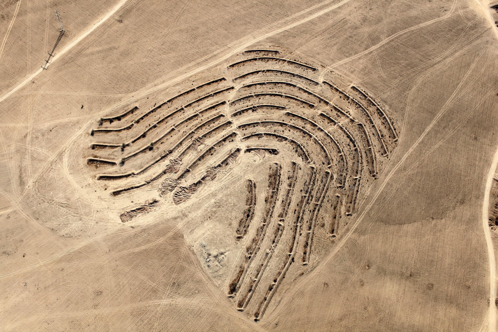
This article appeared in an InsideHook newsletter. Sign up for free to get more on travel, wellness, style, drinking, and culture.
