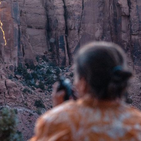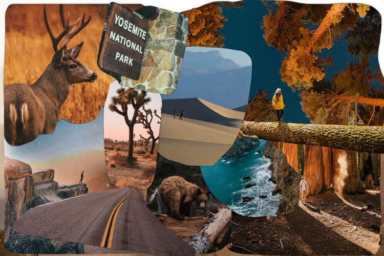
Sunrise at Yosemite Valley draws about the same size crowd you’d find at a little league baseball game. Of its two primary demographics — adventure photographers and cool grandparents — I belong to the former. I’m in the park around five in the morning with a few writers, a couple reps from AutoCamp Yosemite, a new luxury Airstream compound based in a Gold Rush town an hour away, and Chris Burkard.
Chris is an Instagram rockstar: John Muir for the scattered-attention generation. His 3.4 million followers regularly tune in for his freefalls into Mallorcan surfs, supermoon rope-walks above Joshua Tree and devil-may-care perspectives of places like Iceland’s Westfjords or the Na Pali Coast. He’s thirty-something, keeps a studio in San Luis Obispo (where he grew up) and has a credit from nearly every major publication that covers the outdoors, from National Geographic to Outside to Surfer. He also disappears completely — into the woods, of course — not two minutes after we enter the park.
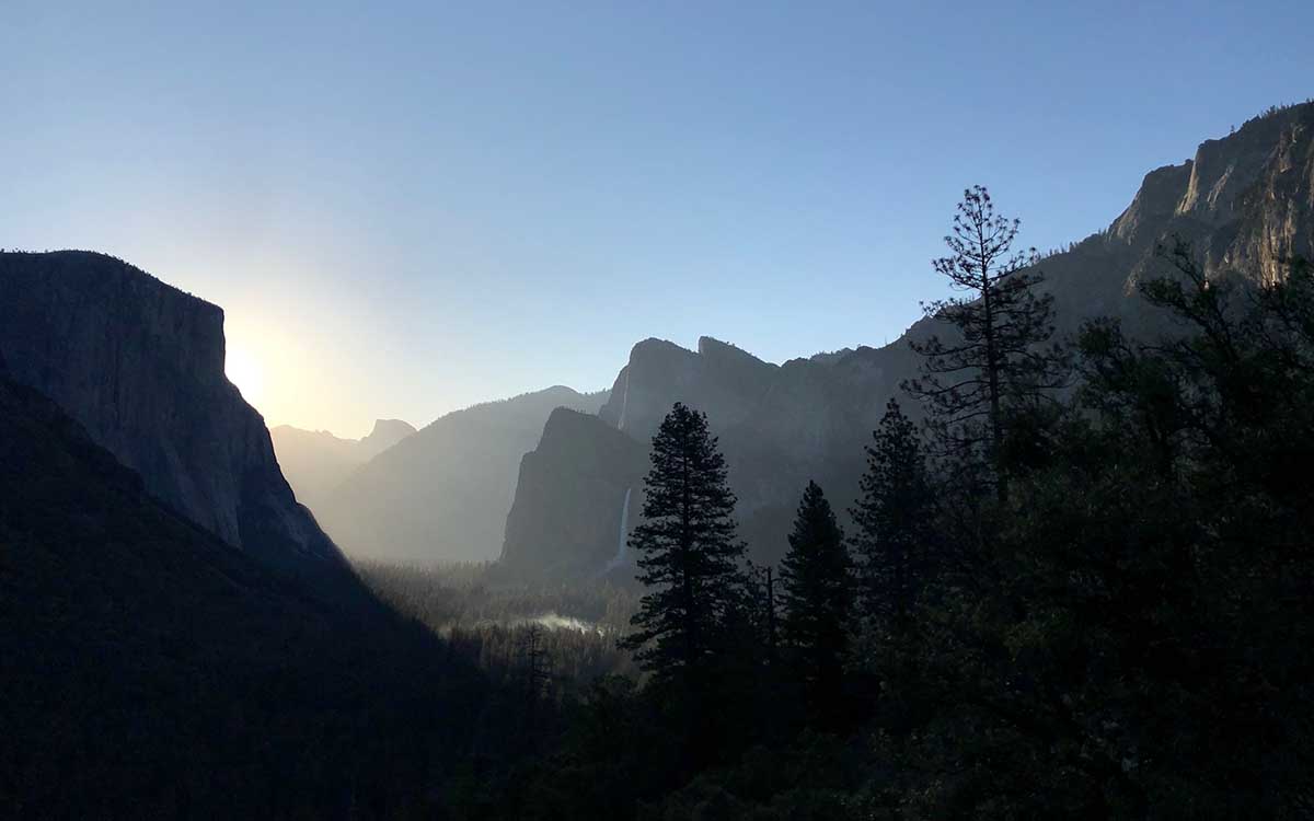
Sunrise isn’t for another 20 minutes, and dawn has only touched the sky, which fades from onyx to a heathered blue and frames the rounded edges of El Capitan. I’m looking at Tunnel View, the ubiquitous vista just past the Wawona Tunnel. It’s Yosemite’s most scenic shot, and definitely a screensaver option on your computer. I take out my iPhone and walk across State Route 41 to look at the Valley. I try shooting a couple photos only to realize part of my phone case is blocking the frame. Where the hell is Chris?
“Ok, I think I’ve found the spot,” he says a few minutes later, emerging from the bushes and looking high on fresh air.
We march up a trail just beyond the Tunnel View parking lot, on stone steps hammered in one at a time over long summers by the California Conservation Corps. It’s dry masonry, so they work without mortar. Any day they lay even two stones is cause for celebration. After a couple minutes on the trail, we fork left, over a downed tree.
“Watch the manzanita bushes,” Chris advises. “They’ll take your backpack.” We weave through the prickly, red-barked shrubs and up another 50 feet or so, until we reach a clearing with levels of rock terraces. We might’ve only hiked 200 feet, and can still hear someone sneeze in the parking lot, but the view is clearly more robust, no longer framed by the road, and entirely our own.
Chris points behind us. Before Tunnel View was built, back in 1933, visitors coming to Yosemite would look over the Valley from a perch higher up. They didn’t arrive in Jeeps and merino wool, but buggies and double-breasted vests. These days you can access that original vantage point via the Pohono Trail, an east-west route that hugs the Valley’s south rim.
Mistakes were made here. The Ahwahne people had lived in the region for at least 800 years before settlers moved in, chasing gold. In the years following, California State Militia burned Ahwahne villages and the newcomers built outposts, contributing directly to the new state’s overnight population explosion. In 1848, California’s non-Native American population was 14,000. By 1852, that number had reached 200,000.
The land was not protected from commercial development until 1864, when President Lincoln declared Yosemite Valley and Mariposa Grove part of the public trust of California, and wasn’t named a national park until 1890, when John Muir realized that domestic sheep were ruining the meadows around the valley, and asked for 1,500 square miles (larger than Rhode Island by 500) to be protected. Even then, the land needed attention and maintenance. While the Ahwahne had routinely performed controlled burns in the Valley to maintain the health of the oak population and keep the forest floor clear of unchecked growth, early settlers didn’t understand the relationship between forest and fire, and worked to prevent burns of any form.
Now, of course, Yosemite officials know better. They’re one summer removed from the 2018 Ferguson Fire, which burned for five weeks over nearly 100,000 acres in the Sierra Nevadas. Controlled burns are already well underway ahead of this year’s fire season. We can see the smoke from our perch, unfurling in tendrils from a clearing near Yosemite Falls.
Chris tells us to take advantage of rim light — the point at which the sun frames El Cap and its surrounding rock formations with a narrow arc of light.
“And for sun flares,” he says, “change your aperture to F16.” He then pulls out his phone. “I also like to use an app called PhotoPills. It plots exactly where the sun will be at each minute. We can expect the sunrise to come around that bend at 6:21.”
I look at the iPhone down in my hand, with its cracked screen and misfit case. I won’t be downloading any apps in the middle of a National Park, but I log the note. Without much fanfare, Chris sort of nod-grins at us and then heads off to the left, presumably to the very best spot within our good spot, and we all disperse, looking for a vantage to stake out the approaching dawn. I hop down two granite boulders, careful not to slip on loose pebbles, and head for the edge of our roost.
At a quarter-to-six, the sun begins to hit the pale granite walls off to my right. It crawls down the Valley, dappling the ridges along the cliffs in light, then the conifers along the forest floor, then Yosemite Falls — all 2,425 feet of it, from the Upper Fall, swollen with runoff after a heavy winter, all the way down to the final 320-foot drop — and finally the Merced River, which flows from here deep into the San Joaquin Valley.
In the distance, Half Dome begins to glow like an anointed basilica, and I snap photos — horizontal, vertical, some framed by the leaves of a tree. All my efforts to jot down descriptions of the scene are vaguely spiritual: “Eden,” “cathedral,” “a marriage of nature.” But the Yosemite Valley is not an ambassador for religion, or peace, or unity. It’s millennia of glacial warfare, the result of a mountain range being shoved to one side and then flipped like a dinner plate. In its cradle, five different life zones fight for food while giant sequoias compete for sun and thunderheads portend destruction overhead.
But in the morning, it’s quiet. I think about this, noticing Chris off to my left. A photo that will reach millions happens here, exactly as the light pokes out from behind El Cap.
We remain up there for close to an hour, rewarded for our 3:30 wakeup with the full might of the California sun, before heading back down to the parking lot. Chris has been visiting Yosemite since he was a little kid. He used to drive up here with his grandpa, and is excited to hear how we all did.
Later in the day, after we’ve taken photos of natural reflection pools and smoking tree trunks, and tied our shoelaces around our necks to wade through the Merced, icy from glacier runoff, I’ll look at my photos and see that they came out alright. Even an iPhone 6S can’t ruin the Yosemite Valley.
This article was featured in the InsideHook newsletter. Sign up now.